|
Around the world by bike
|


|
Darwin airport to Darwin city centre – 14 km The flight from Bali landed in Darwin at 3 in the morning, and after clearing immigration and customs, it was 4 o’clock and still dark. The Australians sure did scrutinise me, opening all the panniers as well as the bike box, even checking the tent pegs! Then it was on to reassembling the bikes. As soon as it got light, at around 6 o’clock, it was on the bikes and into Darwin. One could immediately tell Australia was a first-world country as the many early morning joggers, cyclists and people walking their dogs never looked up to greet us unless they were greeted first.
Chilli’s Backpackers made a good enough place to stay and had a
communal kitchen and outside sundeck with two small pools. The
accommodation was, however, frightfully expensive at AU$30 for a
dorm bed, especially after getting used to paying around US$10
for a double room.
The conveniently located supermarket, next door to the hostel, gave an indication of prices in Australia. After buying a map of the Stuart Highway together with some other bits and bobs, it was back to the ATM to restock the wallet.
I laughed at myself for being slightly shocked at the morals of the western world. It seemed the norm for inebriated people to go about skimpily clothed. Girls in shorts and crop tops danced on bar tables, and it all seemed somewhat immoral after such a long time in Africa, the Middle East, the sub-continent and Southeast Asia. By the end of the evening, I, however, felt comfortable enough to do the same. Well-organised Australia was hard at work to transform Darwin from its wild frontier and hard-drinking-days image to a city more suitable to European standards, but I thought it still had a way to go.
I was, no doubt, in a different country as that evening, while having a beer at one of the pavement cafes, I met a professional rodeo rider. I had no idea one could do such a thing for a living.
13 August - Darwin – Adelaide River - 124 km With dry mouths from too many beers the night before, it was time to leave the party town of Darwin and get on the lonely stretch of road to Adelaide. Due to the late night, it was after 10 o’clock before cycling out of Darwin where a bicycle path followed the highway for about 25 kilometres all the way to Paterson. I thought it amusing that the places who least needed a bike path had one - wouldn’t it have been a novel idea in India or Java.
The Stuart Highway was a motorway which ran for
2,834 kilometres through the Australian outback from Darwin to
Adelaide, referred to simply as "The Track". The
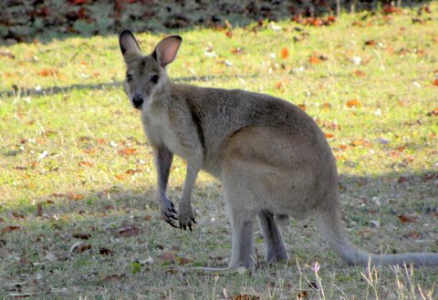
About 50 kilometres into the day, Ernest had his first puncture in Australia. Not long after that, a massive bushfire was burning along the highway. Fortunately, the section next to the highway was already under control, but still a bit too close for comfort. I also spotted my first wallaby. At around 6 p.m., when our shadows had grown long, we rolled into historic Adelaide River with a suitable campsite which had excellent showers, a kitchen area and a beautiful green lawn with shady trees.
The village was situated on the banks of the Adelaide River, well known for its high concentration of saltwater crocodiles but, fortunately, they didn’t visit. The land around Adelaide River was considered the traditional territory of the Kungarakan and Awarai Aboriginal people. Today they are acknowledged as the traditional landowners. The predominantly European place names, however, indicated the early settlers had little respect for this ownership.
14 August - Adelaide River – Pine Creek - 120 km The area was dotted with World War II memorials from old campsites to cemeteries and airfields. Again, there was more than enough water points and camping along the way. The road was perfect and, although hot, it was a dry heat and bearable. Many rest areas were suitable for camping, and some had toilets and even firewood. Hayes Creek was the next water stop, and then it was on to Emerald Springs.
Like most towns along the Stuart Highway, Pine Creek was a gold rush town with a colourful and historical past. I also learned workers on the Overland Telegraph Line discovered gold while digging a hole for a telegraph pole in the early 1870s. The subsequent gold rush lasted for the next twenty years.
15-16 August - Pine Creek – Katherine - 97 km Not surprising, breakfast was coffee with more of the same sandwiches. The rushed departure was due to the flies, which was a menace and it was better to try and out-cycle them. The darn things were irritating, and it seemed they had a preference for eyes and nostrils. The air was extremely dry, making for a flaking skin and cracked lips, and it was only day 3. The road stretched for miles in front, with just the occasional uphill to break the monotony. Water breaks usually were quick ones as the flies soon got the better of us. There were no rest stops or camping along the way, and it was on to Katherine, the third largest town in the Northern Territory.
Coco’s Backpackers gave discount to cyclists and had a
fascinating set up that consisted of a ramshackle building with
various rooms and dorms, plenty chickens and a very unique
owner. It, therefore, made a convenient place to have a rest
day, and do the usual laundry and
Like most of the other towns, the land around Katherine belonged to the indigenous people of Australia, especially the Dagoman, Jawoyn and Wardaman people and the area around Katherine was traditionally considered a meeting place for these tribes. I was, therefore, honoured to meet a few of the local people. It was a brief but fascinating insight into their lives and culture. What I could understand was their view of the world centres around “The Dreaming”, a complex concept of the past, present, and future as well as virtually every aspect of everyday life. It started at the “beginning of time” when mythic beings shaped the land and populated it with flora, fauna, and human beings and left behind the rules for social life. Very much like almost all other beliefs.
17 August - Katharine – Mataranka - 115 km
It
was a very slow start to the day and after 10h30 before getting
on the road. Approximately 28 kilometres south of Katherine a
turn-off led to Cutta Cutta Caves.
Formed millions of years ago, the Cutta Cutta Caves were
somewhat over-regulated with walkways and guided tours –
something I always found slightly disappointing. It was
therefore a quick visit
Fifty kilometres south of Katherine was a rest stop with camping, water and toilets, but as it was still too early for camping, we only ate our jelly sweets in the shade of a large tree and then headed on to Mataranka. Except for an occasional World War II site, the scenery was unchanged since Darwin.
Mataranka had a population of 420 and, surprisingly enough, a campsite known as Bitter Springs Campsite. Most of the towns in the Outback were established due to the availability of water, the discovery of gold or the installation of the Australian Overland Telegraph Line, and Mataranka was no different.
18 August - Mataranka - Larrimah - 81 km An early morning walk led to a hot spring flowing along a clear stream surrounded by natural bush. It was an absolute pleasure to swim in this mineral-rich thermal pool before having breakfast and making more leftover pasta sandwiches for the road. Other campers left pasta and tinned food in the camp kitchen for those who needed it and it came in handy.
It was either a tailwind or downhill (or maybe it was the pasta sandwiches), but we rolled into Larrimah (population 200) before 15h00 and set up camp at the Larrimah Hotel with its legendary Pink Panther bar. Even before paying the camp fee, the town’s entire history was learned. Larrimah was tiny and its only claim to fame was the “Gorrie Airstrip”. The airstrip was built during World War II, and is said to be the longest dirt airstrip in Australia.
Ernest was keen to service his bike's front hub which had been making alarming noises. In typical Northern Territory style, I sat in the shade of a colossal tree watching him.
19 August - Larrimah – Daly Waters - 104 km There were no water stops or rest areas between Larrimah and Daly Waters, and there was nothing to do but push on, stopping at each and every “interesting” spot or memorial along the way - even the occasional road sign got us all excited.
Camping was a few kilometres away at the Hi-Way Inn. I must admit, I have never camped amongst wallabies and parrots before. We, once again, met very friendly and helpful travellers at the campsite who invited us for beer, crab and other delicious snacks. Their motorhome was extremely comfortable, and they truly lived in style.
20 August - Daly Waters - Newcastle Waters - 127 km
I
woke to the raucous sounds of parrots and cockatoos outside my
tent - not an unpleasant way to greet a new day. Birds of all
colours surrounded us. Maybe it was
Newcastle Waters was the next water stop and 127 kilometres away. Many years ago, Newcastle Waters used to be a thriving gathering place for drovers on their overland cattle drives, but with the start of road transport in the early 1960s, the town became a ghost town. At the time of our visit, there was only an old store and hotel left.
Sleeping at rest stops was always fascinating. It was free, and often had water and toilets, with the result there were plenty of “Grey Nomads” in campervans. The people at rest stops also seemed friendlier than most, and there was lots of socialising until late with other travellers, both foreign and local.
21 August - Newcastle Waters – Renner Springs - 118 km The wind picked up during the night, and a long haul into the wind was feared. Fortunately, it was mostly a crosswind and not as strong as expected. Dunmara came after about 45 kilometres and made for a convenient place to fill the water bottles. While doing so, two guys travelling by motorbike also pulled in, and that was about the excitement for the day.
The tarmac laid stretched out in front of us, and amusing
ourselves consisted of picking up all kinds of things and
renaming the birds of Australia. It was a lonely stretch where
even less happened than the previous days, except for two roads
turning off to unknown
For tens of thousands of years, the Warumunga Aboriginal people lived in this area, enjoying the plentiful freshwater and the wildlife attracted by the springs and lagoons. It is estimated that Australian Aboriginal people have been in Australia for at least 45,000–50,000 years. According to historians, Aboriginal people were hunter-gatherers who grew no crops and didn’t domesticate animals (apart from the dingo). I found this fascinating as it meant they were directly dependent on natural resources and that in an area with little to offer, agricultural-wise. Although nomadic, they seemed to have had a strong sense of attachment to sites and areas. It also appeared much of their hunting and gathering was done in the same region, albeit a large one. I only mention this as I think it absolutely marvellous how people could live for 50,000 years in a place, hardly leaving any evidence they were there, and yet there I was, who could within one day generate enough garbage to last many lifetimes. How sad is that? It is not something I’m proud of.
22 August - Renner Springs Road House – Tennant Creek - 166 km The Stuart Highway was more of a tourist trap than wilderness and prices were utterly ridiculous. I guess the shopkeepers knew travellers had little choice but to buy at their price or go without. Even Australians were surprised at the exorbitant prices. Along the way, a loaf of bread could often cost AU$5. Besides the high rates, it was an easy day of cycling on an almost flat road with various opportunities to fill up with water.
A further 50 kilometres down the road brought us to a rest stop, with toilets and water (where walking around was allowed). After filling the water bottles, an Australian couple, camping at the rest stop, came out with two ice cream cones. It sure was the most delicious ice cream cone I’ve ever had.
Back on the bikes, a stiff tailwind pushed us right past Three Ways Junction and on to Tennant Creek, the fourth largest town in the Northern Territory, arriving at the campsite in Tennant Creek just before 6 p.m.
23 August - Tennant Creek
A day of leisure was spent in Tennant Creek, as the campsite had an internet connection, it was a busy day of uploading photos, posting updates and stocking up with foodstuff for the next few days. I was wondering if I’d ever fit all that shopping into my panniers. The rest of the day was spent doing long overdue laundry and fiddling with bikes and tents.
I also learned about the history of the one-eyed Jack Noble, who teamed up with his friend and financier, William Weaber (who was totally blind). Together they established the Nobles Nob Mine - a mine that, during its productive life, produced over 32,500 kilograms of gold. I loved these little settlements, as there was always a story to be told.
24 August - Tennant Creek – Wauchope – 120 km
The
wind picked up during the night, making for a somewhat reluctant
start to the day. Cycling into a headwind was never a pleasant
affair, and it was 10 o’clock before two somewhat unwilling
South Africans got on the road. The wind was, fortunately, not
as bad as
Towards the end of the day, the scenery suddenly changed. Huge rocks stacked upon one another covered the area, a stunning sight at sunset. Known as Devil’s Marbles, it made for fantastic exploring, and it was indeed a remarkable place. After chatting to another cyclist, cycling around Australia, the sun was already setting, and the nearby National Parks campsite appeared a perfect overnight stop. I already had my tent up when Ernest pointed out there was no water, and it was better to pack up and cycle the 10 kilometres or so to Wauchope Roadhouse.
The sun had, by then, already started setting, making for a bright red sky, with a huge full moon rising on our left, a truly spectacular sight. A lone dingo trotting past made it even more special.
25 August - Wauchope – Wycliffe Well – 18 km
Wauchope was already quite far south, and it became icy during the night; it was the first time in nearly a year I needed sleeves. I was in no mood for cycling as I woke to a howling wind but packed up and headed for Wycliffe Well.
Wycliffe Well is said to be located on a cross-section of key lines, or energy lines. This may also be the reason why Wycliffe Well has had its fair share of UFO sightings. The pub had a large collection of paper clippings stuck on the wall about UFO sightings in the area. I was keen to see if I could also spot some and decided to camp right there in their excellent grassy campsite. I kept my eyes peeled for a UFO but wondered if the sightings could have had anything to do with the large selection of beer they sold in the pub.
26 August - Wycliffe Well A howling wind, and rain pattering down on my tent, made me pull the sleeping bag over my head and announce I was going nowhere. It wasn’t all that hard to convince Ernest. The roadhouse not only made good French fries but also had internet, and offered bottomless cups of coffee. During the day, another cyclist heading north arrived and, lo and behold, would he not be from South Africa. After coaxing him to stay the night, he pitched his tent, and it was a very sociable evening.
27 August - Wycliffe Well – Barrow Creek – 94 km With winter setting in it was getting somewhat more difficult to emerge from the tents as outside it was bitterly cold, but after coffee and toast (made on the fire) it was time to say goodbye to Clyde. First stop was Taylor Creek Rest Area where water was available for filling water bottles.
The day consisted of cycling into a slight headwind and, on reaching Barrow Creek, it was time to call it a day. Barrow Creek was a bit of a godforsaken place with hardly a campsite at all, but a welcoming pub. Barrow Creek was also where one of the Outback’s most horrific and mystifying crimes took place. The story goes that on the night of 14 July 2001, Bradley John Murdoch stopped a VW Kombi van. The van was driven by an English traveller, Peter Falconio, who was persuaded by Murdoch to leave his vehicle. Murdoch then shot the visitor, tied up Falconio's girlfriend, Joanne Lees, who, miraculously, managed to escape after hiding in bushes along the road, and who was eventually picked up by a truck driver who took her 13 kilometres south to the Barrow Creek pub where the police were alerted. The body of Peter Falconio was never found.
Although still early, the nippy weather called for early camping. Ernest cooked his usual pasta, and it was off to bed rather soon.
28 August - Barrow Creek – Ti Tree – 93 km Being on the way by 9h00 was an early start for Ernest, and it made for an early arrival at Ti Tree. All the talk about a potato salad made us shop for potatoes, lettuce, vegetables and mayonnaise.
With all the ingredients bagged, it was off to the campsite. Soon after pitching the tents and making coffee, a kind lady, camping close by, brought us fruitcake that went very well with the coffee. The people from the Outback are the kindest and most accommodating people one will ever meet in Australia.
It was still relatively early, and pleasant to sit in the sun while Ernest prepared the much-anticipated meal. Ti Tree was a tiny settlement, and its only claim to fame was that it was the closest settlement to Central Mount Stuart, the geographical centre of Australia. The area was also known as Anmatjere Country and encompassed a region of approximately 4,000 square kilometres. At the time, it was estimated that 2,000 people lived throughout the Anmatjere region and at least 60% of the population spoke Anmatjere as their first language.
29 August - Ti Tree – Aileron – 63 km
It
was best to wait for the sun to warm the tents before packing
up. A short ride from Ti Tree brought us to vineyards and a sign
for wine tasting where I splashed out on a bottle of port. The
first rest stop of the day came about 40 kilometres down the
road, perfect for filling water bottles and eating potato salad
sandwiches. From the rest area, it was only
It was a freezing cold night, and Ernest made “vetkoek” (deep-fried dough balls) and soup that went exceptionally well with the port. A zillion stars lit the sky while I sat wrapped in my sleeping bag, but not even the port could keep the cold at bay.
30 August - Aileron – Tropic of Capricorn Rest Area – 105 km On leaving Aileron, I first snapped a pic or two of the giant 17-metre-tall Anmatjere Man, erected in 2005 and weighing 8 tonnes.
The rest of the day was spent cycling into the wind. Ernest was energetic and led the way while I sat in his slipstream. The Tropic of Capricorn Rest Area made perfect camping. Later a motorcyclist, who had been riding from Germany, also rocked up and it was interesting to learn he had followed a very similar route to us since Turkey.
31 August - Tropic of Capricorn Rest Area – Alice Springs – 36 km
Camping next to the Tropic of Capricorn Monument was maybe not such a good idea as early morning travellers arrived to take pictures of the monument. I guessed they would have to photoshop me out once home.
We blitzed the last few kilometres into Alice Springs – mostly downhill, passing the marker for the highest point on the route between Darwin and Adelaide (a mere 727 meters) – and then cycled into Alice, the halfway point on the Stewart Highway.
I was both in pressing need of a shower and a dentist. The day was nice and warm, even hot for a change, and it was time to do laundry and air the sleeping bags.
1-3 September - Alice Springs
I
went in search of a dentist as a loose crown was causing
problems, the gory details of which I will spare you. Off to the
dentist I went
I was a little disappointed in the Australian barbie, as
saveloys,
something that looked like viennas on steroids, was cooked with
onion and potato slices on a gas-fired plate – not even a grid.
At least Ernest was happy, grid or no grid. It was his first
real meat-eating country since he left South Africa (besides
insects, dog, and the occasional chicken or goat, and, of
course, pork).
The following day was spent shopping for foodstuff for the next few days. Ernest bought a new tyre as well as pedals from the local bike shop, and I splashed out on a new bike computer. The weather report predicted heavy storms, but not much came of the expected wind or rain, only a sudden downpour towards evening.
The plan was on leaving the following day but, by then, it was raining, and nothing came of our plans. The reception/shop at the camp had a small selection of books to swap, and I located an easy to read one and crawled back into my sleeping bag. Later in the day I was tempted to carry on cycling as the sun came out every now and then, and the wind was favourable.
4 September - Alice Springs - Stuart’s Well – 95 km
Stuart’s Well was nothing more than a roadhouse and rest stop with a grassless, red earth campsite. One couldn’t complain as it was free and the dust made for a most extraordinary sunset and the clear night sky, complete with shooting stars was a bonus. Warning signs told us not to leave anything near the fence as the horses around the perimeter had an appetite for things like towels, tents and bicycle saddles. We understood that not long before the seat of a Harley was chewed.
5 September - Stuart’s Well – Erldunda – 111 km
There were two rest stops with water en-route to Erldunda, and
therefore, no need for carrying lots of water. Both looked very
inviting, but it was too early for camping. The trees that
accompanied us all the way since Darwin gave way to shrubs and
grassland. Unfortunately, the meteorite conservation was nearly
40 kilometres off the road. I would have loved to have visited.
The
Henbury Meteorites Conservation Reserve contains 12 craters
which
were formed when a meteor fell there 4,700 years ago. The Henbury Meteor,
Instead, it was on to Erldunda Roadhouse that had a restaurant/pub, campsite and pre-fab motel rooms. Erldunda Roadhouse was also the turn off for Uluru (Ayers Rock), our next destination and a rather long detour of 500 kilometres there and back to see “The Rock”.
That particular area was known as the red centre as the soil colour was a deep red – especially stunning at sunset but not always suitable for camping as, by then, all the gear had a reddish tint. Even the lone dingo spotted had a slightly red back. Interestingly enough, I noticed a sign on a fence, warning poisoned bait had been put out for “wild dogs”. I suppose “wild dog” sounded more acceptable than “dingo”.
6 September - Erldunda – Rest Area – 135 km
At the first one, we were entertained by Daryl and Gloria travelling in a campervan. After chatting to them for a while, drinking their coffee and eating all their fruitcake, it was back on the bikes and on to the next rest area. Never waste a tailwind, I always say. When I say “rest area” I mean, what I know as a lay-by, a dirt area next to the motorway where vehicles can pull off.
7 September - Rest Area – Curtin Springs – 28 km
A rather miserable day greeted us. It was threatening to rain
and a strong wind picked up during the night, making the tent
flaps roar like a Boeing in the process of taking off. While
having coffee, another cyclist pulled in. It was Carson from
Taiwan, of whom we have heard from
Cold, wet and windswept we arrived at Curtin Springs and, after a coffee, it didn’t take much convincing to pitch the tents. The camp emu wasn’t all that welcoming, and I walked away quickly, but the emu followed close behind. I walked faster and faster, eventually running flat out, with emu still in tow. On the next round, and with the smooth action of a well-trained Olympic diver, dived in to the tent and stayed there for the rest of the day. Only once did I venture out (checking carefully for the emu) to get a loaf of bread from the roadhouse shop, this time at AU$7. It must have been the most expensive bread in the world at that time.
8 September - Curtin Springs – Yulara – 88 km
The weather cleared during the night and in the morning a huge
rainbow greeted us. The dreaded emu was back, inspecting
everything and pecking on the tents. It must have been time to
wake up. Dark clouds gathered and kept us tentbound, but by
11h30 the weather gave
us a break, and packing up was at the
speed of light and it was on the bikes for the
What a gruelling day of cycling it turned out to be. A gale-force wind blew all day, and it was heads down, battling on to Yulara. Eventually, the Yulara Resort camp and my first glimpse of Uluru in the distance came into view. By the time the tents were pitched, there wasn’t a breath of wind, and the cold weather seemed to have dissipated.
Yulara was the service village for the Uluru-Kata Tjuta National Park, and I had to give it to the Australians, they could market anything, even a rock. Yulara offered a wide range of accommodation, hot-air balloon rides, dinner under the stars, camel rides, 4-wheel rides, helicopter flights and much more.
9 September - Uluru – 37 km
After the usual rest day chores, it was a leisurely cycle to the rock. I was surprised at the size of Uluru; somehow, I expected it to be much smaller. It was quite a dramatic sight as it rose 350 metres out of the desert floor and measures 9.4 kilometres around its base. The sun didn’t want to play along and hardly ever came out to give the rock its distinctive red colour. After snapping a few pics, it was back to the campsite for more idle chatter with the other campers.
In a way, it was quite sad that such a sacred site to the Aboriginal people was trampled by tourists climbing the rock. Notices were up asking people not to venture to the top, but still, it appeared many found this a kind of a pilgrimage.
10 September - Yalara – Curtin Springs – 88 km Ernest changed his worn tyre, and it was 12h30 before leaving the campsite. It was, fortunately, a much more relaxed day than anticipated. The wind wasn’t as strong, arriving at Curtin Springs shortly after 5 p.m. where one could buy wood for making a campfire. Rudolfo from Argentina, who then lived in Melbourne, also camped at Curtin Springs, and it was a sociable evening spent around the fire with a few beers.
11-12 September - Curtin Springs – Mt Ebenezer – 107 km
After the usual leisurely start, it was on the road and a battle
into the wind for the rest of the day, crawling into Mt Ebenezer
with its red, earthy campsite shortly after 5 p.m. I couldn’t
resist the French fries from the roadhouse, and before setting
up camp, I devoured a whole five dollars’ worth.
The next morning, I woke at 5h30 with rain pelting down on the tent. The entire campsite had, by then, turned into a giant mud bath. There wasn’t much to do but lay cocooned in the tents, waiting for the weather to clear. There was, however, no such luck as it rained throughout the day.
Eventually, a break in the weather made me sprint for the roadhouse pub/restaurant where one could at least work on the laptop and have a cup of coffee.
13 September - Mt Ebenezer – Kulgera – 135 km The following morning, the weather had cleared, and an excellent tailwind helped us along the 60 kilometres to the Stuart Highway junction at Erldunda. From there the road beat a dead straight track south through the desert. Another 75 kilometres along the Stuart Highway brought us to Kulgera, with a good campsite and roadhouse. Kulgera was nothing more than a pub and restaurant and had a population of only 40.
14 September - Kulgera – Rest Area – 61 km
An icy wind blew, and I was reluctant to leave. Battling into the wind was one thing, but cycling into a freezing wind was another. Twenty-two kilometres further south the route officially crossed into the state of South Australia.
At the border was a rest area and it was good to see Gloria and Daryl again, whom we had met on the way to Ayres Rock. Once again, they invited us for coffee and cake. I wonder if these people realise what luxury it was for us.
Forty kilometres further was another rest area with water and shelter. Another camper at the rest area invited us to share his campfire, and I was quick to get my billy on the fire for my evening coffee. The people in the Outback were always very accommodating and kind, and sharing food and water came naturally to them.
15 September - Rest Area – Marla – 125 km As I woke, I could hear the unwelcome sound of rain on my tent. The rest of the day was spent cycling in icy conditions and in a constant drizzle. I was frozen stiff all day.
On the bright side, I considered myself lucky to have seen wild horses and, yes, a big kangaroo, sitting right in the middle of the road.
I was never more pleased to ride into a campsite. A quick cup of soup with leftover deep-fried dough balls and a hot shower was what I needed to defrost myself. Marla was the first settlement in South Australia and was nothing more than a small hamlet with gum trees and a campsite. With a population of around 70, Marla wasn’t much more than a service town for people heading up or down the Stuart Highway.
16 September - Marla – Cadney Homestead – 85 km A signboard stated it was still 1,082 kilometres to Adelaide. Ernest repaired punctured tubes and after stocking up from the little mini-mart, it was already 12h00.
Another cold and windy day, and remote Cadney Homestead only rolled into view after 5 p.m. It was a favourite overnight stop on the Adelaide–Alice Springs drive as it had heaps of camping space as well as a roadhouse.
17 September - Cadney Homestead – Pootnoura Rest Area – 80 km
The section between Cadney Homestead and Pootnoura was another short distance that took the entire day to cycle. It was, once again, a bleak day with low clouds and an icy wind. Ernest had two blow-outs due to his new back tyre tearing along the side-wall.
The weather wasn’t in our favour, and it was a miserable day on the road. I stuck the iPod in my ears and battled on. Pootnoura Rest Area had both water and shelter and, as it looked like rain again, I had my tent up super-fast, and by super-fast I mean SUPER-FAST, as by then I was pretty good at pitching the tent.
18 September - Pootnoura Rest Area – Coober Pedy – 78 km It was a struggle to make coffee in the windy conditions but, eventually, the water was boiling for an early morning cuppa. I wasn’t looking forward to another stormy day but had to move on as supplies were running low.
The dog fence, a 5500-kilometre long barrier running across South East Australia to keep the dingoes out, wasn’t something I have ever heard of before until about 40 kilometres north of Coober Pedy. Another surprise was Cooper Pedy and the opal country with its many holes and piles of dirt. Opal mining was alive and well in Coober Pedy, and I understood why it was often referred to as “The Opal Capital of the World”.
19-20 September - Coober Pedy
Coober Pedy was a typical small mining town with corrugated iron
houses, dirt roads and eccentric-looking foreigners seeking
their fortune.
21 September - Coober Pedy to Ingomar Rest Area – 94 km
It was time to leave the life of hanging around the campsite and
get back on the
Before leaving, I tried to draw money but the bank was offline and I set off without any cash. At least there would be no need for it within the next few days as a road sign stated there were no facilities for the next 254 kilometres. At least the rest area was (as happened at the free camping places) interesting with the usual bunch of odd and unique people.
22 September - Ingomar Rest Area – Bon Bon Rest Area – 79 km
I couldn’t believe it was another day of making our way into the wind on a pan-flat road with very little change in scenery. On and on the road went and it was head down into the wind. I was close to getting white-line fever. Fortunately, it was a short day and once at the rest area, could pitch tents and get a break from the wind. The most fascinating people are at these rest areas and Jen from Adelaide was a 70-year-old lady who drove all the way to Darwin to deposit her late husband’s ashes into the ocean. She was a most remarkable woman with loads of captivating stories and the more red wine were drunk, the more interesting the stories became.
23 September - Bon Bon Rest Area – Glendambo – 87 km Ernest and I weren’t on speaking terms, the wind was relentless and the route pan-flat, and I couldn’t think of anything worse. Cycling on in silence, a genuinely miserable situation, all I wanted was to get out of there.
Glendambo was an important stopping point on the Stuart Highway as, when travelling north, this was the last petrol for the next 250 kilometres. With a population of around 30 and an annual rainfall of only 185mm, it will never, in my opinion, become more than a roadside stop. It, however, had camping, a hotel/motel, a licenced restaurant, roadhouse and general store, and it was all I needed.
24 September - Glendambo – Woomera – 125 km
Thank goodness, not all things are constant, and once on the
road, a tailwind
powered us south past vast areas of nothingness
until reaching Lake Hart, once Australia’s prized salt deposit.
The salt lake filled with water after good rains, making for
magnificent views with
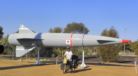
Like two horses who smelled the stables, it was possible to speed right past Woomera was it not for me having a flat tyre. I think, by then, both wanted to get this trip over and done with so each could go their own way. Woomera had a bit of a dark history as it was the headquarters for experimental rocket and nuclear tests. I read that indigenous people suffered greatly from these nuclear fallouts. In the centre of the village was a rocket display area, and I was surprised at how small some of these deadly rockets were.
25 September – Woomera - Ranges View Rest Area – 120 km Past more salt lakes and some dusty rest stops we cycled, and I was surprised to find water at Ironstone Lagoon Rest Area, about 70 kilometres south of Pimba. That night, camp was at Ranges View where the wind blew an absolute gale - I honestly thought my tent was going to take off with me inside.
26 September - Ranges View Rest Area – Port Augusta – 66 km
The following morning, it was a beautiful spring day - sun shining, hardly any wind and flowers everywhere. The Stuart’s Desert Pea flowers were in full bloom and covered the soil nearly as far as the eye could see.
I was relieved to roll into Port Augusta, which also marked the end of the very long Stuart Highway and to find myself in a more built-up area. The campsite was a bit out of town but was inexpensive and had excellent facilities. The beer-drinking John, who lived in the park, made for an alternative outlook on life.
27-28 September - Port Augusta
29 September - Port Augusta – Port Germein – 70 km
After two days at leisure, life on the road was resumed. A
strong headwind battered
us all day, but we struggled on
regardless. In fact, it became so strong it was getting outright
dangerous to
be out cycling. Trucks and buses blew one all over
the road and
Port Germein was a rather forlorn-looking place with just a few houses, a small hotel and general store, the jetty and a campsite. It was a crabbing area, and each and everyone seemed to have a crab net for fishing off the pier.
30 September - Port Germein – Snowtown – 98 km
In Snowtown, a community with a population of 600, three churches, a hotel and general grocer, we set up camp. Camping was in the Centenary Park community recreation area, where there was a perfectly manicured bowling green, tennis court and, of course, the football oval which doubled as a cricket pitch in summer.
1 October - Snowtown – Dublin – 89 km
Tiny Dublin had such a convenient rest area, we camped for the night and only the following morning noticed the small “no camping” sign.
2-5 October - Dublin – Adelaide – 62 km
It was on October 2 and on a breezy but sunny Saturday afternoon
that we rode
Camping was at Adelaide Caravan Park for the night, again ever so orderly to such an extent I couldn’t make up my mind if it were boring or peaceful. Located on the banks overlooking the Torrents River, it was a beautiful location and rather quiet, but then again with so many camp rules, there wasn’t much space for spontaneity and people seemed to hide in their mobile homes, too scared to talk to us, just in case it was against the rules. I missed the good old rest areas from the Outback with its eccentric travellers.
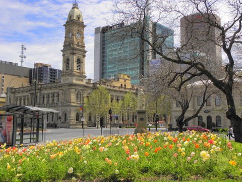
Nevertheless, Adelaide remained a pleasant, spacious city with
loads of parks, river walks and cycling tracks. A very liveable
city, except for its 750 churches that I was
sure could put a
damper on any city. We strolled endlessly around city malls and
scenic river paths, ate pizzas and drank beers at sidewalk
cafes, ate their famous chocolates and, in the
Possums came to visit in the campsite, black swans floated down river, and in the morning we were woken by parrots. It was a long weekend, and all the shops closed until Tuesday. I bought a new rear hub for my bike that Ernest fitted but, in return, I had to buy him a set of tyres for his bike.
I finally came to a decision regarding my plans for the near future. The plan (which seemed to change from day to day) was to cycle to Melbourne and then fly (via South Africa) to South America to start the long haul north in summer.
6 October - Adelaide – Mt Barker – 40 km
Mt Barker made for an excellent stop to get out of the weather and to enjoy some of the lovely red wine from the region to ward off the cold. Not a bad day at all. Living in one of the cabins of the campsite was a South African family who’d just immigrated and was still searching for a house – good luck to them.
7 October - Mt Barker – Tailem Bend – 79 km
It was bitterly cold as our path followed back roads past Littlehampton, Nairne, Native Valley, Callington and onto Murray Bridge. These tiny villages were picture-perfect, ever so neat and orderly and came with lovely old, restored buildings. It was a pleasant ride past farmlands and horsey areas, and the llamas I spotted didn’t look too out of place.
From Murray Bridge, a path ran south along the west bank of the Murray River. The headwind was blowing storm-strength; I lost my sense of humour somewhere along that stretch and wondered just what exactly I was doing out there on a bicycle. At Jervois a motor pontoon took people across the river to Tailem Bend. After setting up camp, a hot shower, a glass of the local red and an enormous bowl of pasta, my sense of humour returned, and things didn’t look all that bleak after all.
8-9 October - Tailem Bend – Meningie – 63 km
Meningie was situated on the shores of Lake Albert with beautiful views over the lake. The wind subsided, the sun set over the lake and pelicans drifted past while terns ducked and dived in search of their evening meal. A perfect ending to what was a rather unpleasant and windy day. In fact, it was so lovely the following day was also spent in Meningie.
10 October - Meningie – 42 Mile crossing – 83 km
From Meningie the route ran along the Coorong National Park. What an excellent day of biking it was. A slight tailwind and magnificent views of the famed wetlands with its abundant birdlife made it a pleasure to be on the road. I loved the place names in that part of the world as the route led through Policeman’s Point and Salt Creek to 42 Mile Crossing, where camping was at a rather basic park camp. The water tank was dry, the “camp kitchen” had been taken over by a swarm of bees, and flies and mozzies were attacking at the same time.
11 October - 42 Mile Crossing – Robe - 112 km
I don’t know what it was about me and the wildlife in Australia.
While packing up, I got bombed by a magpie - he, apparently,
thought I had
Camping right on the ocean was something I always enjoyed. A stroll into the village revealed a restaurant serving veggie burgers, and I was delighted not to eat pasta again. The French fries were such a huge helping it bordered on rudeness.
Along the road, we met a Dutch lady (Anneke) cycling in the opposite direction. She came to visit her daughter and was cycling back to the Netherlands. She had no watch, no odometer and no cycling partner. As she said, all she needed was a credit card, passport and water. She cycled when it was daylight and slept when it got dark. Way to go, Anneke!
12 October – Robe
I woke to the unwelcome sound of rain on my tent. A steady drizzle settled in, and it didn’t look like the kind of rain that was going to clear any time soon. I was more than surprised to see Ernest already packed up, and that for someone that can never get going! There was no getting me out of my tent in such foul weather and I stayed put.
13 October - Robe – Millicent - 81 km The next morning, I listened carefully for the sound of rain but, fortunately, didn’t hear anything. The lack of rain made for a rather hasty departure. It was still bitterly cold, and I was dressed for the Arctic. Along the way were three other Australian cyclists, cycling from Adelaide to Sydney, and I looked at their bikes and gear with great envy.
14-15 October - Millicent – Mt Gambier – 53 km
By the next morning, the weather deteriorated even further. I lay cocooned in my tent, listening to the wind and rain for most of the day. I, fortunately, found some girlie magazines in the camp kitchen and a packet of chocolate-coated peanuts in my pannier. That, together with numerous cups of coffee, kept me occupied for much of the day.
16-17 October - Mt Gambier – Portland - 106 km One can only be stuck in a tent for so long. Dressed in my new winter woollies, I got back on the bike in freezing weather, accompanied by occasional rain and high winds. Not my best day of cycling - I could have sworn I was back in England.
18 October - Portland – Warrnambool – 105 km
There was even time to explore the quaint and historic Port Fairy. With its many old buildings and pretty wharf, it surely must have been a popular place in summer. Warrnambool was much larger than expected and had a campsite right in the centre of town and within easy walking distance from the shops. It was hot shower, hot chocolate and choc-chip muffin weather and it was precisely what I did.
19 October - Warrnambool – Port Campbell - 71 km
The sun came out for the first time in days, making for a somewhat slow start as it was such a pleasure sitting in the sun. The route continued past many a dairy farm, cheese factories, and miles and miles of picturesque pastures, I even spotted a few black swans.
Eventually, the road spat us out at the coast and the renowned Great Ocean Road. I wasn’t disappointed. This scenic and dramatic coast draws thousands of tourists with prices to match. The wind and ocean had eroded the limestone to form spectacular pinnacles, coves, caves and arches - a truly magnificent sight. It was a good day on the road, turning off at every chance to admire the view and take a few snaps.
20 October - Port Campbell – Lavers Hill – 52 km Luckily, it was another sunny day with little wind. The first stop for the day was at Loch Ard Gorge, another dramatic viewpoint, then on to the famous 12 Apostles. Soon, the route left the coast and headed uphill through eucalyptus forests to Lavers Hill, a small settlement perched atop the Otway Ranges. It was a slow but beautiful ride to the top. We saw the three cyclists from Adelaide from time to time along the way. In Lavers Hill, I was hoping to see the glow worms but none came out and after sun set, I found it too cold to go exploring.
21 October - Lavers Hill – Kennett River – 73 km
From Lavers Hill, it was a downhill ride reaching speeds of over
50 kilometres per hour. It did, however, not last long, and soon
the way climbed up the hill through the
From Apollo Bay to Kennett River, the path ran along a magnificent stretch of coastline, and that evening camping was at a campsite across the street from the beach. With koalas in the trees, ducks and colourful birds, it was close to a paradise. Also camping was Alan and Heather from England, who had been cycling for the past nine months (on that particular trip). The incredible thing was we previously met them at Kannur in India two years before.
Ernest cooked a large dish of pasta, but it was too much to finish, and the leftover pasta was left in the pot. The next morning, we found the lid under the tree and the bowl empty.
Unfortunately, Ernest also heard his mother had passed away the previous day. R.I.P. Mrs Markwood, may your soul have a wonderful journey.
22 October - Kennett River – Anglesea - 56 km After chatting to Alan and Heather, it was midday before leaving. It was also the first warm day in ages, making for enjoyable biking. It was a beautiful coastline along the shore past Lore and Aireys Inlet. The weather came in and, fortunately, Anglesea came into view just before the rain came down.
23 October - Anglesea – Rosebud – 80 km
Instead of cycling via Geelong on the western side of Port Phillip Bay to Melbourne, the ferry from Queenscliff across the mouth of the bay to Sorrento looked a more novel way. From Sorrento, one could cycle to Melbourne along the eastern shore. It was the right choice as the stretch from Sorrento was a scenic one.
The path from there to the campsite at Rosebud ran alongside the coast and, although it was all built up, it was effortless cycling. Instead of cooking, I splashed out on pizza from the shop across the way from the campsite.
24 October - Rosebud – Melbourne – 80 km
It didn’t take long to spot a backpackers along King Street, aptly named King Street Backpackers. Nothing in Australia was cheap, but it was comfortable accommodation, with neat, clean rooms, a kitchen and a large communal area. Although being in a place where everything was closed and locked-up made me feel somewhat claustrophobic.
25 October – Melbourne
Much of the day was spent organising a flight from Melbourne to
Cape Town, South Africa (where I intended to spend time before
flying on
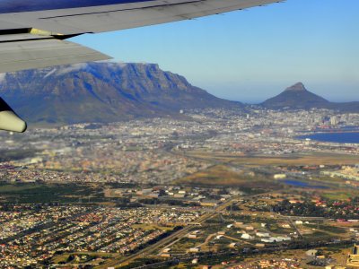
26-27 October - Melbourne, Australia – Cape Town, South Africa - By aeroplane It was another long and tedious flight from one end of the world to another. I was happy to have the opportunity to stop over in Cape Town instead of flying directly from Melbourne to Buenos Aires, Argentina. In those days, it was a direct flight with a refuelling stop in Cape Town and passengers had the option to break their journey in South Africa at no extra cost. It was great to see my family again. We wasted no time and immediately got out the wine and ordered pizzas. Some things never change. |